25 December 2018

eCognition Developer 9.01 full Crack Download

eCognition Developer is a powerful development environment for object-based image analysis. It is used in earth sciences to develop rule sets (or applications for eCognition Architect) for the automatic analysis of remote sensing data.


Features & Benefits
  • Superior collection of object-based image analysis tools and algorithms
  • Analyzes raster, vector and point cloud data
  • Intuitive development environment
  • Scalable from a single desktop to enterprise production workflows
  • Software Development Kit (SDK)
  • Online access to ruleset resources
eCognition Developer can be applied for all common remote sensing tasks such as vegetation mapping, feature extraction, change detection and object recognition. The object-based approach facilitates analysis of all common data sources, such as medium to high resolution satellite data, high to very high resolution aerial photography, lidar, radar and even hyperspectral data.                                                                                                                       
Download Link:
Installer + Crack                                                                                                                                    
Cracking Process:                                   
1. Extract and install the software with 'set license later'
2. Overwrite patch folder.

3 September 2018

Advanced Remote Sensing: Terrestrial Information Extraction and Applications (Request only)

Advanced Remote Sensing is an application-based reference that provides a single source of mathematical concepts necessary for remote sensing data gathering and assimilation. It presents state-of-the-art techniques for estimating land surface variables from a variety of data types, including optical sensors such as RADAR and LIDAR. Scientists in a number of different fields including geography, geology, atmospheric science, environmental science, planetary science and ecology will have access to critically-important data extraction techniques and their virtually unlimited applications. While rigorous enough for the most experienced of scientists, the techniques are well designed and integrated, making the book's content intuitive, clearly presented, and practical in its implementation.
Key Features
  • Comprehensive overview of various practical methods and algorithms
  • Detailed description of the principles and procedures of the state-of-the-art algorithms
  • Real-world case studies open several chapters
  • More than 500 full-color figures and tables
  • Edited by top remote sensing experts with contributions from authors across the geosciences.

Download Link:

Links will be provided as you comments your email id.

1 September 2018

ENVI 5.3 Full crack Download

Harris Geospatial Solutions provides software for the analysis and visualization of scientific data and imagery. The company develops products such as IDL, ENVI and IAS which are used in a variety of industries, including remote sensing, engineering, geology, aerospace, defense and intelligence, and medical imaging.
What’s New in ENVI 5.3
ENVI 5.3 is packed full of new features and functionality that will help you do more with your geospatial data than ever before.
  • NEW significant LiDAR point cloud analysis and visualization capabilities now come with your ENVI software, including ENVI API enhancements to programmatically access point clouds for custom extension development, batch processing, and enterprise deployments.
  • NEW synthetic 3D point-cloud generation from stereo optical imagery to take advantage of existing commercial imagery archives and create point-cloud and terrain products in areas where collecting LiDAR is not feasible or more expensive than simply acquiring imagery.
  • NEW enhancements to the spatiotemporal analysis toolset to view and understand how any given pixel in a scene has changed over time.
  • NEW additions to the ENVITask system enable users to programmatically call discrete bits of image processing through the ENVI API.
  • NEW IDL Python bridge to seamlessly integrate Python code into ENVI or wrap ENVI analytics into ArcGIS®.
Download Link:

20 August 2018

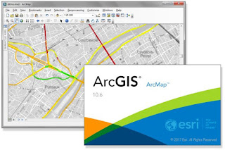
ArcGIS 10.6 Desktop full crack download

What's New in ArcMap 10.6
ArcMap 10.6 is primarily a quality improvement release focused on increasing performance and fixing bugs.
Updates to ArcMap 10.6 include

  • New and updated 3D Analyst tools for working with LAS datasets.
  • New Network Analyst tools for creating network dataset layers from other layers and templates.
  • Support for the PostGIS geography type to store spatial data in PostgreSQL databases and geodatabases.
Download Link:

13 May 2018

Some Tutorial On GIS & Remote Sensing PDF

Here I give some tutorial, which enhance your GIS and remote sensing skills. Some of my friends 
and researcher help me to getting this tutorial. It will help you lots.. Some tutorial helps use of gis software..

Download Link:
1. How to use IDRISI Selva
2.E cognition MANUAL
3. Getting Started with ENVI

25 April 2018

Rockware Rockworks Full Crack Download

RockWorks is the standard in the petroleum, environmental, geotechnical and mining industries for surface and subsurface data visualization, with popular tools such as maps, logs, cross sections, fence diagrams, solid models and volume calculations.
RockWorks offers numerous options for analyzing your surface and subsurface data, and accepts many different data types, such as stratigraphy, lithology, downhole geochemistry / geophysics / geotechnical measurements, color intervals, fractures, and aquifer data.

Download Link:

Cracking Process:
Youtube

ERDAS IMAGINE 9 FULL CRACK DOWNLOAD WITH LPS

ERDAS IMAGINE is a powerful remote sensing and image analysis program. It is a gateway to multiple integrated geospatial technologies, intuitively guiding a user through their

experience with powerful tools and functionality.


 You can easily create robust data analysis, including Python scripting, export to OGC WPS and batch processing commands.

Download Link:

Cracking Process:

6 March 2018

ArcGIS 10.5 Desktop full crack download

ArcGIS 10.5 arrives at a time when organizations worldwide are challenged to make sense of real-time digital information. The release helps them glean insight from enterprise data, big data, and the Internet of Things and share that insight in intuitive ways.
The heart of ArcGIS 10.5 includes:
  • Improved capabilities for handling large-scale analytics and big data.
  • A drag-and-drop interface that streamlines the creation of spatial analysis through maps, charts, and graphs.
  • Collaboration features to connect and analyze information across the enterprise.

“If organizations are not looking at data spatially—as it exists in the world around them—they will overlook patterns and trends that impact their business and clients,” said Jack Dangermond, founder and president of Esri. “ArcGIS provides the tools to accelerate their digital transformation, helping them master the analysis of big data, real-time data, and information from the Internet of Things.”
The new release is headlined by ArcGIS Enterprise, a significant evolution of the technology formerly known as ArcGIS for Server. ArcGIS Enterprise has been updated to meet the needs of today’s information-dependent organization, with improved power to process and analyze large, disparate datasets. Data that once required hours of processing can now be analyzed in minutes, delivering quick insight from billions of data records.
Another prominent feature of ArcGIS 10.5 is Insights for ArcGIS, a drag-and-drop interface that streamlines spatial analysis of geographic and enterprise data through intuitive maps, charts, and graphs. In addition, enhanced collaboration tools allow users to break down siloes and deliver insight across departments and agencies.
Organizations can deploy ArcGIS 10.5 in the manner that best fits their business needs—on premises, in the cloud, or as software-as-a-service—with industry-standard security and scalability.
In addition, ArcGIS 10.5 meets the challenge of analyzing big data with new capabilities such as:
  • Improved integration of social media feeds, allowing users to integrate Facebook and Google accounts using their own logins.
  • Ready-to-build, sharable solutions for raster, vector, and tabular data.
  • Streamlined deployment to leading cloud providers, including Microsoft Azure, Amazon Web Services, and IBM Cloud.
  • Enhancements to ArcGIS Pro and ArcGIS Online—including batch-analytic toolsets, vector tile basemaps, and code-free app building—that bring 3D data from drones and unmanned aerial vehicle (UAVs) to mobile devices.
ArcGIS 10.5 makes it easier for organizations to discover and deliver insight from important data. Through this cutting-edge platform, organizations can leverage the world’s most powerful spatial analysis technology anywhere, on any device, behind the firewall or in the cloud, and can easily discover the spatial insight that matters to them—more quickly, more efficiently, and with more confidence.
Download Link:
Installer + Crack 

Special  Thanks To
Cương Nguyễn Trọng (Đào tạo)

Cracking Process:
Youtube 

13 February 2018

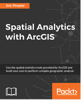
Spatial Analytics with ArcGIS Book Pdf (Request Only)

Spatial statistics has the potential to provide insight that is not otherwise available through traditional GIS tools. This book is designed to introduce you to the use of spatial statistics so you can solve complex geographic analysis.

The book begins by introducing you to the many spatial statistics tools available in ArcGIS. You will learn how to analyze patterns, map clusters, and model spatial relationships with these tools. Further on, you will explore how to extend the spatial statistics tools currently available in ArcGIS, and use the R programming language to create custom tools in ArcGIS through the ArcGIS Bridge using real-world examples.
At the end of the book, you will be presented with two exciting case studies where you will be able to practically apply all your learning to analyze and gain insights into real estate data.

Download Link:
Links will be provided as you comments your email id.

Featured post

Are you interested in sharing any thoughts?

Are you interested in sharing your thoughts, if so then you are most welcome. You write everything about Remote Sensing and Geographic Inf...

Popular Posts